
Product · Map
Map & assets
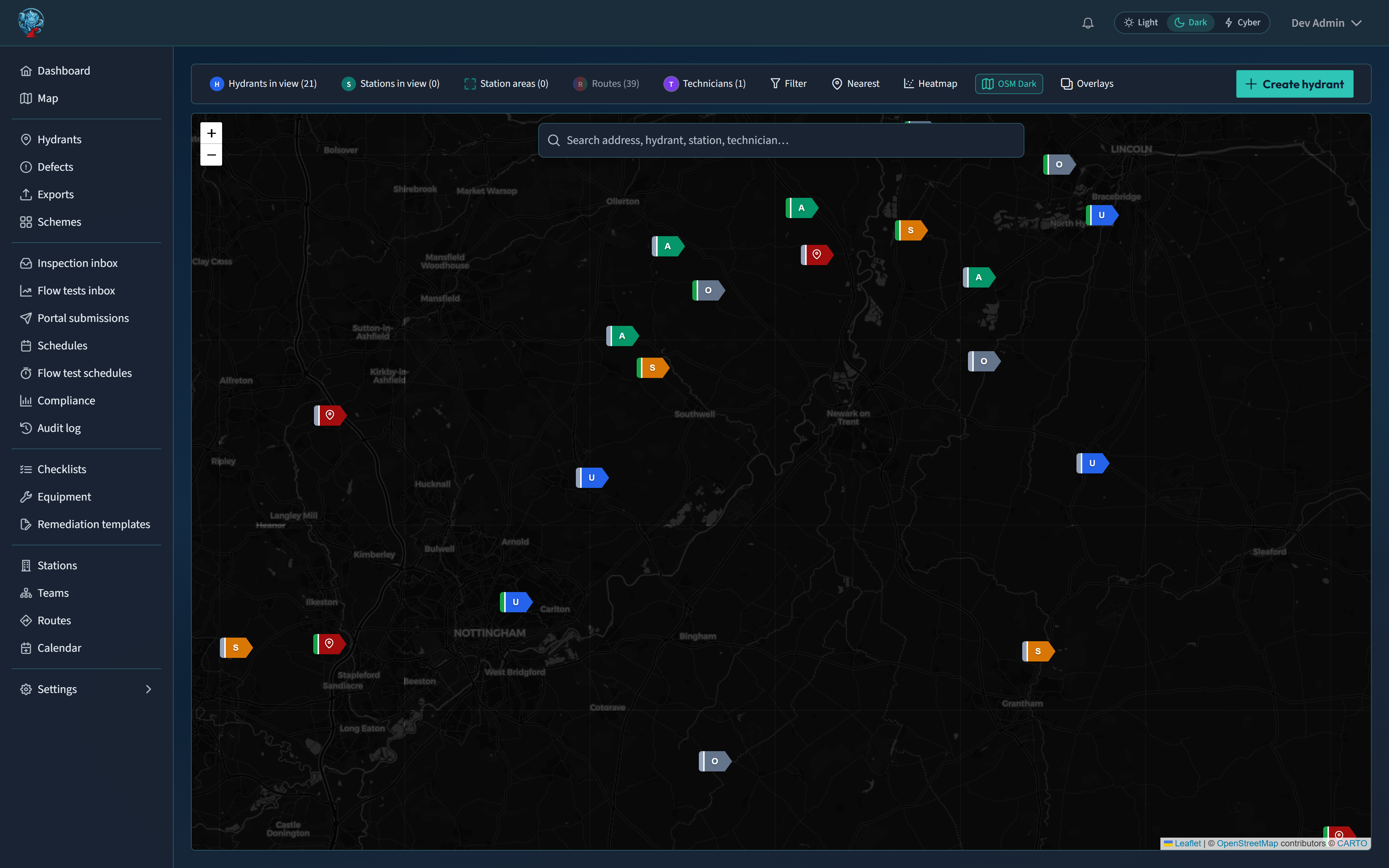
Scattered hydrant records across paper and spreadsheets leave coverage and risk hard to see. Hydreon puts every asset on a living map with history attached.
Ops teams filter by what’s due, defective, or at risk; stations reconcile hydrants into their ground; and Street View sits beside the map when you need eyes on the street before you leave the desk.
What you get
- Interactive hydrant map with filters, risk / due / defect heatmaps, and coverage views
- Hydrant register: status, ownership, NGR, undertaker refs, pressure/flow history, attachments
- Ordnance Survey basemaps & geocoding (OSM fallback)
- Street View beside the ops map
- Station boundaries with reconcile of hydrants into stations
Works with
Ordnance Survey · Street View · PostGIS spatial foundation · Android offline packs
UK basemaps first; spatial history stays with the asset so field and desk share one register.
app.hydreon.co.uk
See Hydreon on your ground.
Request a demo and we’ll walk through map, inspections, routes, and the water company portal with your service in mind — including how desk planning and Android fieldwork fit your stations.